At Jimatech, we spend a lot of time thinking about how to make roads safer. We recently looked at how AI uses “eyes” to see what is happening on the street through digital images. It’s a big step forward, but if we want to get serious about fixing our infrastructure, we have to admit something: just seeing the road isn’t enough.
If you want to create a professional report that a local government can actually use, a simple picture of a pothole doesn’t tell the whole story. To turn an image into a useful metric, we need to talk about localization.
The Problem with Just Using Images
Imagine an AI sees a large crack in the pavement. Without more data, that AI doesn’t know if that crack is a minor annoyance on a country road or a major safety risk on a busy highway.
To create an accurate output, the AI needs to know specific things that aren’t in the photo:
- Exact Location: It needs the GPS coordinates. A pothole without a location is just a picture; it isn’t a work order.
- Transport Data: It needs to know the road names, surface types (paved or unpaved), speed limits, and how many lanes the road has.
- Street Type: Is this a main road, a side street, or a bridge? The rules for how we fix these are very different.
- Local Rules: Every city has its own standards. What one town calls “fair condition,” another might call “poor.”
- Geodata and Metadata: Information like the time of day, camera type, and surrounding infrastructure (like nearby drains or sidewalks) helps place the image in the right context.
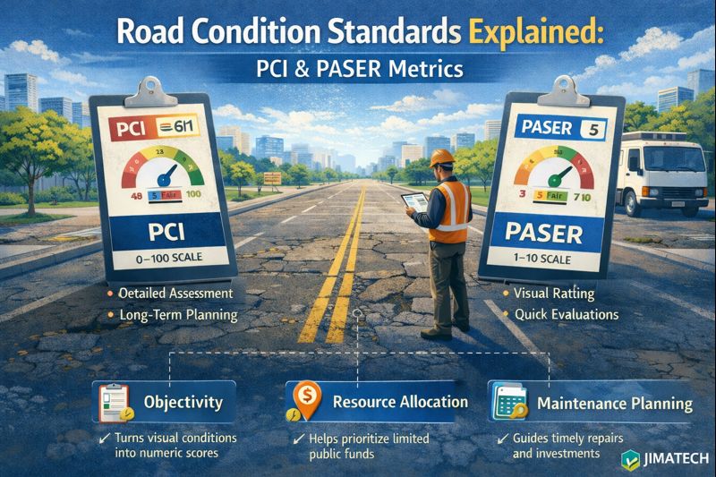
Without this context, the AI might give you a score that simply doesn’t make sense for that specific spot. This is why we can’t rely on basic images alone to hit industry standards like PCI or PASER.
The Importance of Localization
Localization is the process of making sure the AI’s “vision” is tied to local facts. It means the AI isn’t just looking at pixels; it is connecting those pixels to a specific place, a specific set of laws, and a specific local need.
For the output to be right, the AI has to use local information to judge its findings. If the AI knows it is looking at a high-speed road in a city with strict maintenance rules, it will rate a crack much more seriously than if it were on a dirt path.
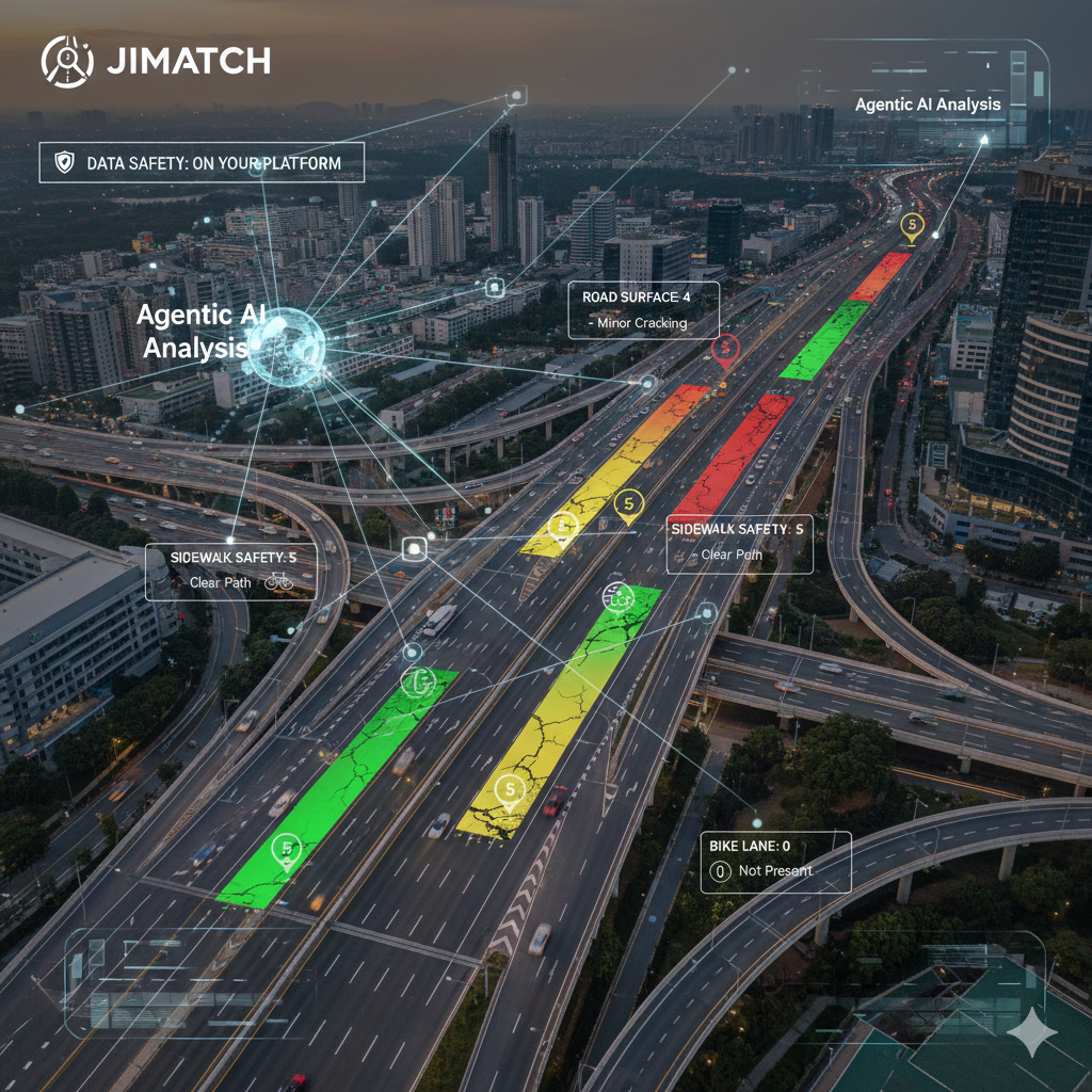
The Next Step: Agentic AI Systems
To get this right, we are moving away from simple AI models and toward Agentic AI.
An “Agent” is an AI that doesn’t just wait for you to give it data, it goes out and finds what it needs to finish the job. An Agentic system doesn’t just look at your street photo; it actively acquires the local information required to make the report accurate.
Here is how an Agentic system works:
- It Sees: It looks at images to find road damage and surface issues.
- It Locates: It pulls the geo-location data to find the exact spot on the map.
- It Learns: It looks up the road names, surface types, local government standards, and speed limits for that area.
- It Reports: It combines all of this to create a report that actually follows local requirements.
By moving to this kind of system, we ensure that the AI isn’t just guessing. It becomes a smart partner that understands the rules and regulations of the real world.
At Jimatech, we believe this is the only way to build infrastructure that lasts. We aren’t just teaching machines to see; we are teaching them to understand where they are and what the local community needs.